9 VINE ST
Owner Information
BURT IAN P
9 VINE ST
AMESBURY, MA None


Property Details
9 VINE ST is classified as a Single Family Residential (Conventional).
The primary structure on this property was built in 1920. There are 2,124ft2 of built area within this property. There is 1,176ft2 of residential/living space within this property. This property is listed as having 7 rooms.
9 VINE ST is valued at $406,000. The land is valued at $199,100 and the structures are valued at $204,400. There is an additional valuation of $2,500 on this property.
This property is in Zone R20. Confirm with local Zoning Board authorities to ensure there are no overlays or other easements on this property.
The most recent deed for 9 VINE ST is recorded at the local registrar in Book 35085, Page 495. 9 VINE ST was last sold on Friday, July 15, 2016 for $315,000.
Assessment data from fiscal year 2022.
Flood Data
According to the FEMA National Flood Hazard Layer, this property does not appear to be in a flood zone. It may also be in an area not yet reviewed. Nonetheless, confirm this information prior to taking any action.
To view the flood hazards around this property, create a FEMA "Firmette" Map of the area around 9 VINE ST.
Broadband Internet Providers
| Provider | Type | Bandwidth (mbps) | |
|---|---|---|---|
| HughesNet | Satellite | 25 | 3 |
| Verizon New England Inc. | DSL | 15 | 1 |
| Comcast | Cable | 1000 | 35 |
| GCI Communication Corp. | Satellite | 0 | 0 |
| T-Mobile | Fixed Wireless | 25 | 3 |
| Viasat Inc | Satellite | 100 | 3 |
| VSAT Systems, LLC. | Satellite | 2 | 1 |
Broadband service provider data from December 2020.
Adjacent Properties
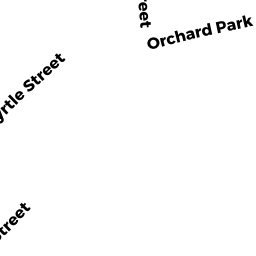
- 9 MYRTLE ST
Single Family Residential owned by BRIGGS RICHARD S - 13 MYRTLE ST
Two-Family Residential owned by PERREAULT JR FRANCIS E - 5 VINE ST
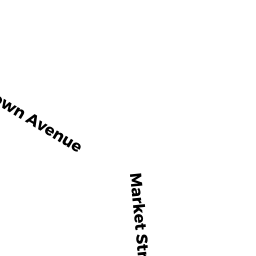
Single Family Residential owned by LANNON JOHN - 3 BROWN AVE #88
Residential Condominium owned by APRIL ROBERT J - 3 BROWN AVE #89
Residential Condominium owned by BAILEY KENNETH E - 3 BROWN AVE #90
Residential Condominium owned by SWENSON ELYCE M - 3 BROWN AVE #91
Residential Condominium owned by QUINN KAITLIN - 3 BROWN AVE #92
Residential Condominium owned by PAWLICK JANICE A - 3 BROWN AVE #93
Residential Condominium owned by PARADISE DIANE M - 3 BROWN AVE #94
Residential Condominium owned by PLANTE JONATHAN G - 3 BROWN AVE #95
Residential Condominium owned by KUNTZLER LAURO - 3 BROWN AVE #96
Residential Condominium owned by MEGCS REALTY TRUST - 1 BROWN AVE
Other, Open Space owned by MASTER DEED - 1 BROWN AVE #27
Residential Condominium owned by LINDAHL JEAN TR - 1 BROWN AVE #25
Residential Condominium owned by LIBERTY DOROTHY E - 1 BROWN AVE #26
Residential Condominium owned by CUSHMAN JENNIFER A - 1 BROWN AVE #28
Residential Condominium owned by JOHNSON KERRIN - 1 BROWN AVE #29
Residential Condominium owned by CASSIDY THOMAS P - 1 BROWN AVE #30
Residential Condominium owned by BROWN KENNETH J - 1 BROWN AVE #31
Residential Condominium owned by PULEIO SHARON M - 1 BROWN AVE #32
Residential Condominium owned by SAMET SCOTT - 1 BROWN AVE #33
Residential Condominium owned by RICH COURTNEY ANN - 3 BROWN AVE #87
Residential Condominium owned by EVANS LILLIAN A - 1 BROWN AVE #35
Residential Condominium owned by MCRAE LOUISE S - 2 BROWN AVE #58
Residential Condominium owned by MATERKOWSKI MICHAEL S - 1 BROWN AVE #34
Residential Condominium owned by SNOW SUZANNE - 1 BROWN AVE #36
Residential Condominium owned by FRANCHEK NELL E - 1 BROWN AVE #37
Residential Condominium owned by STEPHEN P COPPOLA SUPP NEEDS TRUST - 1 BROWN AVE #38
Residential Condominium owned by PAGLIARULO ROBIN G C - 1 BROWN AVE #39
Residential Condominium owned by THORSEN ROSE - 1 BROWN AVE #40
Residential Condominium owned by HAMELERS MARIA - 1 BROWN AVE #41
Residential Condominium owned by ALMONTE MILAGROS - 1 BROWN AVE #42
Residential Condominium owned by MANN DEWEY - 1 BROWN AVE #43
Residential Condominium owned by GAMBLE RICHARD A - 1 BROWN AVE #44
Residential Condominium owned by SUSAN C FERLAZZO TRUST - 1 BROWN AVE #45
Residential Condominium owned by PERRY JANICE - 1 BROWN AVE #46
Residential Condominium owned by RUEBEL FAMILY REALTY TRUST - 1 BROWN AVE #47
Residential Condominium owned by SACCO ELLEN S - 1 BROWN AVE #48
Residential Condominium owned by CERASE HEIDI E - 1 BROWN AVE #49
Residential Condominium owned by VARTANIAN DOREEN T - 2 BROWN AVE #50
Residential Condominium owned by PERKINS CAROLYN M - 2 BROWN AVE #51
Residential Condominium owned by DODGE, LAWRENCE E - 2 BROWN AVE #52
Residential Condominium owned by FELDMAN GARY - 2 BROWN AVE #53
Residential Condominium owned by TROTTIER ROBERT M - 2 BROWN AVE #54
Residential Condominium owned by COLBY GAIL M - 2 BROWN AVE #55
Residential Condominium owned by BROTHERS DAVID G - 2 BROWN AVE #56
Residential Condominium owned by LOISELLE BRETT D - 2 BROWN AVE #57
Residential Condominium owned by DESANTIS JAMES M - 2 BROWN AVE #59
Residential Condominium owned by FICOCIELLO ELEANOR D - 2 BROWN AVE #60
Residential Condominium owned by HAGAR CHRISTINE A - 2 BROWN AVE #61
Residential Condominium owned by WALDMAN ELIZABETH J - 2 BROWN AVE #62
Residential Condominium owned by ROONEY SEAN P - 2 BROWN AVE #63
Residential Condominium owned by BISHOP THOMAS - 2 BROWN AVE #64
Residential Condominium owned by GUILD DOROTHY T - 2 BROWN AVE #65
Residential Condominium owned by 2 BROWN AVENUE TRUST - 2 BROWN AVE #66
Residential Condominium owned by PHILLIPS SCOTT R - 2 BROWN AVE #67
Residential Condominium owned by GILL STEPHEN - 2 BROWN AVE #68
Residential Condominium owned by MCDOUGALL THOMAS C - 2 BROWN AVE #69
Residential Condominium owned by FLYNN KATHY M - 2 BROWN AVE #70
Residential Condominium owned by LEYDEN DEBORAH - 2 BROWN AVE #71
Residential Condominium owned by ANDERSON JUDITH E - 2 BROWN AVE #72
Residential Condominium owned by KRISTIANSEN JUNE L - 3 BROWN AVE #73
Residential Condominium owned by CROSS THOMAS N - 3 BROWN AVE #74
Residential Condominium owned by ALAKA ARMAND J - 3 BROWN AVE #75
Residential Condominium owned by GALLO GINA M - 3 BROWN AVE #76
Residential Condominium owned by SOLARI JOANNE - 3 BROWN AVE #77
Residential Condominium owned by FAIA GARY S - 3 BROWN AVE #78
Residential Condominium owned by VEDRANI JESSICA M - 3 BROWN AVE #79
Residential Condominium owned by SCHOLZ MARK A - 3 BROWN AVE #80
Residential Condominium owned by DAVIS DONNA M - 3 BROWN AVE #81
Residential Condominium owned by THE CASSIDY FAMILY REVOCABLE TRUST - 3 BROWN AVE #82
Residential Condominium owned by DURGIN HOWARD F - 3 BROWN AVE #83
Residential Condominium owned by BEASLEY REBECCA E - 3 BROWN AVE #84
Residential Condominium owned by DAVID P RECZEK REVOCABLE TRUST - 3 BROWN AVE #85
Residential Condominium owned by LAUREN CARVINO REVOCABLE TRUST - 3 BROWN AVE #86
Residential Condominium owned by HOYT MICHAEL R - 11 VINE ST
Single Family Residential owned by MAUGHAN DOUGLAS L